Clinton Mile 264
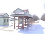
The beginning
Machens Mile 27
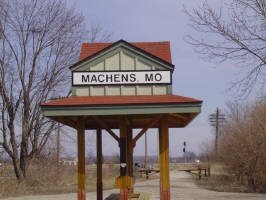
The goal
Sunday, April 22, 2007
It's all about logistics
Whelp. Traveled the entire trail by car from Clinton to Machens this weekend. I checked every trailhead to make sure there really was water where the "official map" said there was. I also checked to see if there were any stores that sell water near the "dry" trailheads. I learned the hard way not to trust what the "official map" said about water availability at trailheads in the past. I also checked every campground, park, and side trail to verify its existence. I think I'm ready to go. My next step is to go through my pack again to see where I can lighten up in order to compensate for the extra water I'll need to carry on certain legs. The Sedalia to Pilot Grove leg (26 miles between water sources) will be the hardest.