Here's the answer to a question almost everyone asks: Why?
The answer actually has 4 parts.
First I want to prove I can do it. I haven't had a major challenge since the marathon in 1996 and basically want to see, as Rocky says, "if there's anything left in the basement".
Second, because very few people have hiked the trail end to end.
Third, I love & teach history. There's a lot of history associated with the Katy.
Fourth , to prove something to my son and former students. I've always preached that you can do anything you want as long as you have a goal and am willing to work hard to get there.
I hope this answers the questions for everyone.
Clinton Mile 264
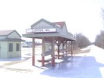
The beginning
Machens Mile 27
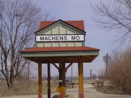
The goal
Sunday, May 27, 2007
Sunday, May 13, 2007
Quicky
Gas dropped so I grabbed a quick 10 miler. I hiked from Clifton City to Mile Marker 210. Long steady incline heading east. I still need to work out the water dilemma from Sedalia to Pilot Grove.
Saturday, May 5, 2007
Minor setback
I'm faced with a few minor setbacks in hike preparation now that gas is $3.15 a gallon. The closest trailhead is 30 miles away so I'll be doing local hikes on the roads near my home. It's not going to be the same as hiking along the Katy but I guess a hike is a hike for training purposes. I'm also not able to make a day drive to try and answer any unanswered questions about facilities, water, etc. But, as my father used to say: "You need horse sh** to grow a good garden".
Monday, April 30, 2007
15 miler
Hit the trail Sunday. Good hike, went from Treloar to Marthasville and back, adding on another mile at the end for good measure. Using a hiking staff now. Jello calves at the end, sore today. I'm going to do some exercises to improve my calves and try some different pack configurations.
Sunday, April 22, 2007
It's all about logistics
Whelp. Traveled the entire trail by car from Clinton to Machens this weekend. I checked every trailhead to make sure there really was water where the "official map" said there was. I also checked to see if there were any stores that sell water near the "dry" trailheads. I learned the hard way not to trust what the "official map" said about water availability at trailheads in the past. I also checked every campground, park, and side trail to verify its existence. I think I'm ready to go. My next step is to go through my pack again to see where I can lighten up in order to compensate for the extra water I'll need to carry on certain legs. The Sedalia to Pilot Grove leg (26 miles between water sources) will be the hardest.
Thursday, April 12, 2007
The Clinton-Sedalia leg.
I'm planning on hiking the Clinton-Sedalia leg a week from Saturday. This is just about the only portion of the trail I've yet to hike. I'll be experimenting with a few ideas on how to pack things. It looks like 16 on Saturday, 9 on Sunday, and 9 on Monday. Then it's a long sleepy Amtrak ride home.
Sunday, April 8, 2007
Subscribe to:
Posts (Atom)